.png)

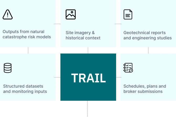
NatCat
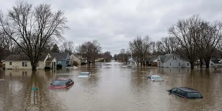
• Flood
• Wildfire
• Wind
• Seismic
• Extreme rainfall


Large submission packages arrive fragmented across email, SharePoint, secure links while other data stay in portals.
20+ open tabs and weeks spent filtering, structuring and preparing a coherent risk report.
Risk engineers operate under compressed turnarounds. There's little room for delays.
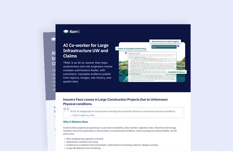
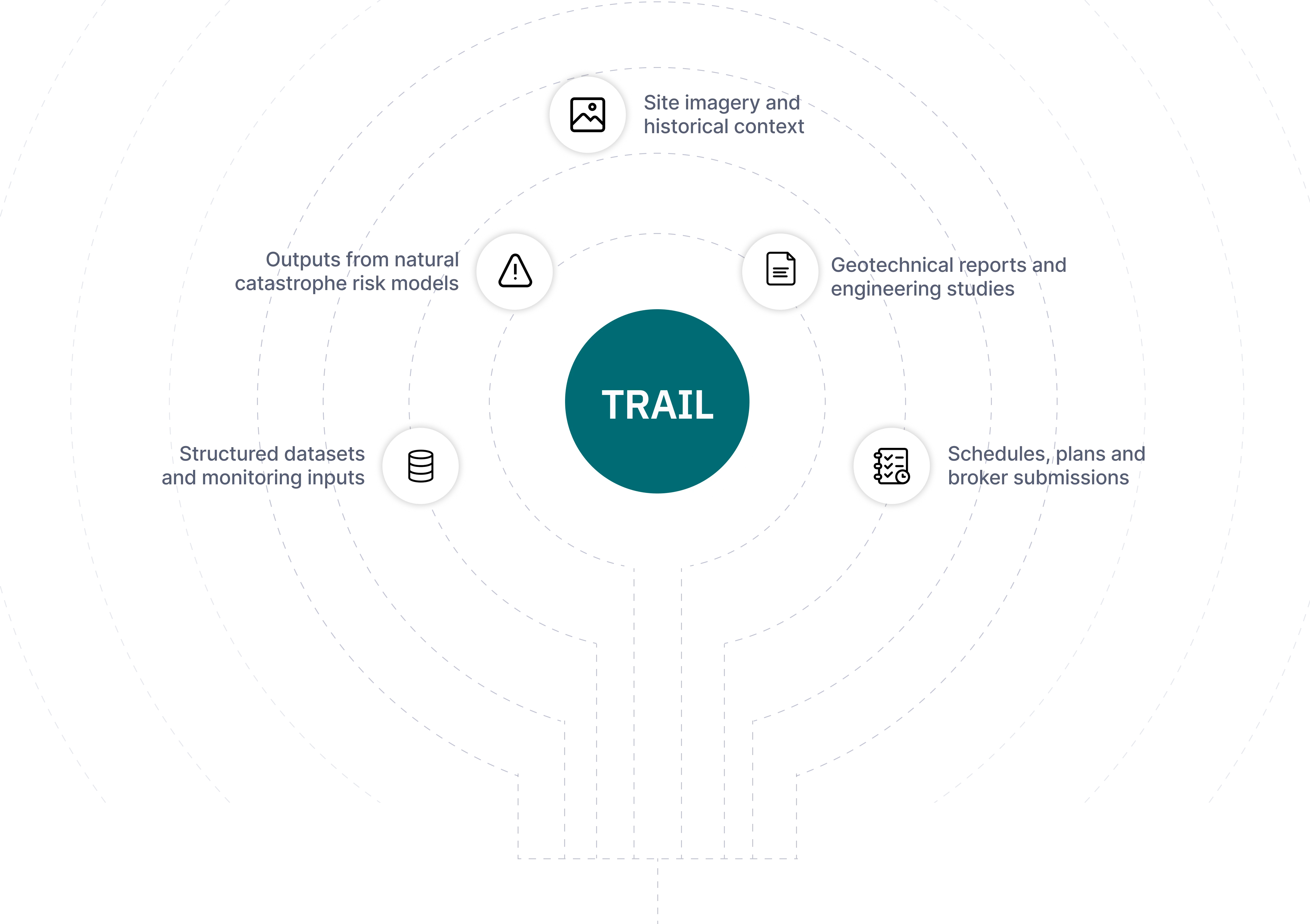
A four-page overview of TRAIL platform, its evidence layers and features.

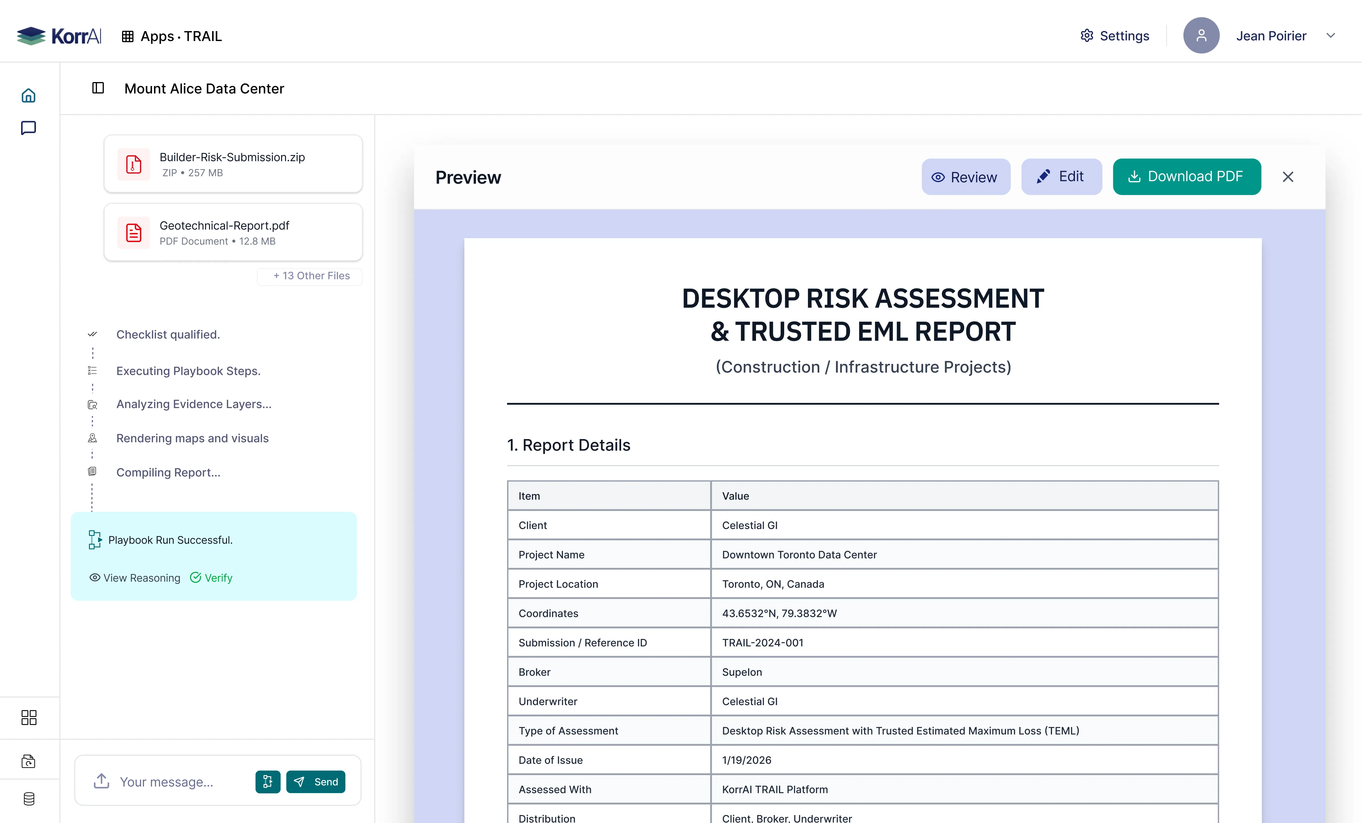
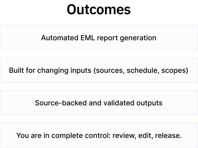
Playbooks are AI-reasoning workflows that reflect how risk engineers actually conduct desktop studies.
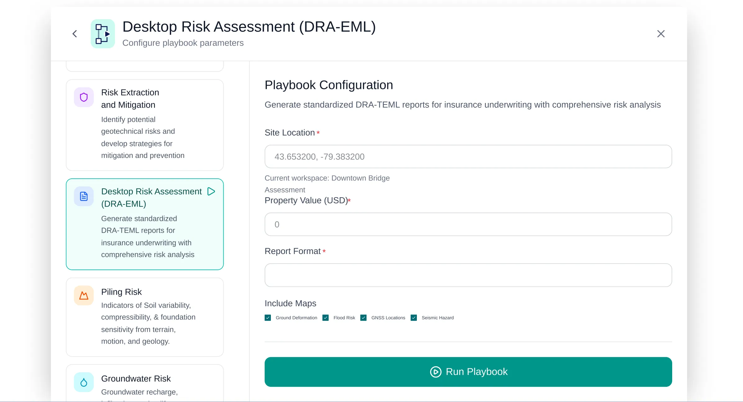
Each run is reviewable, auditable and traceable with datapoint/ page level citations.
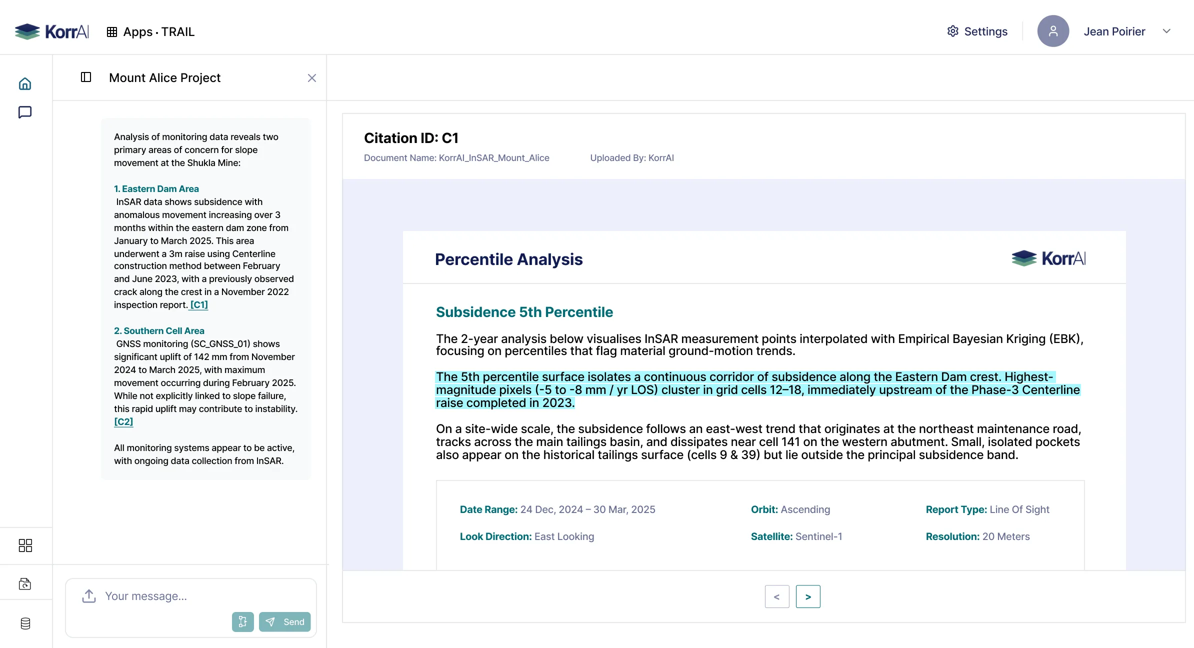
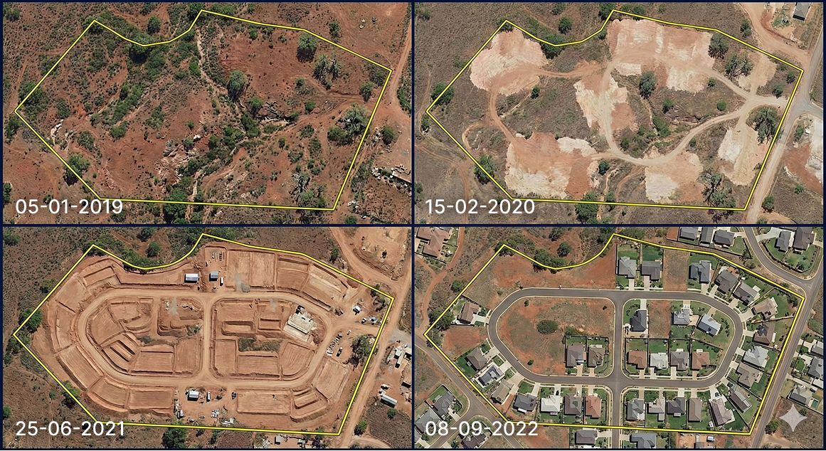
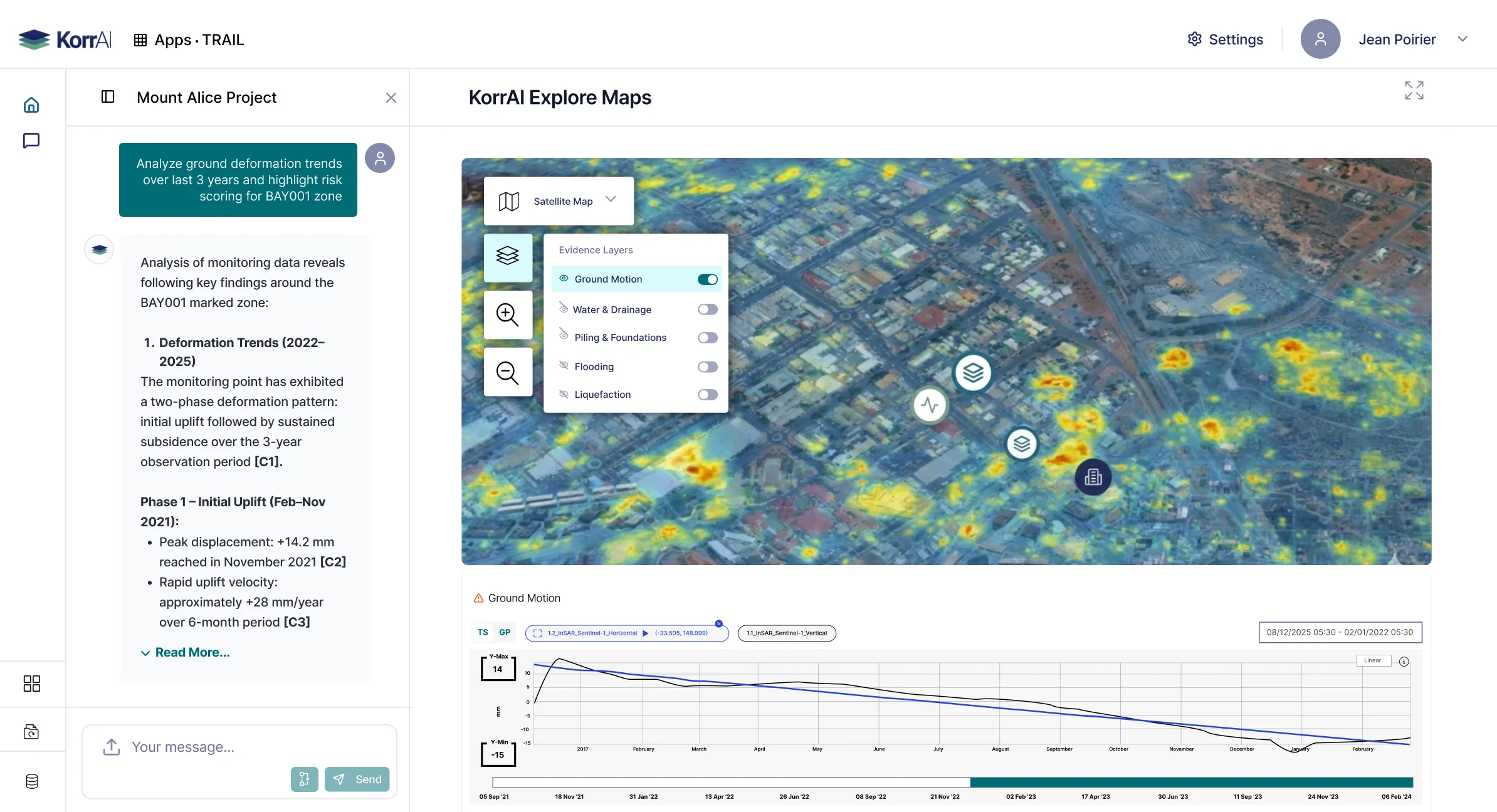
Enable evidence layers over maps, do deeper spatial review. TRAIL plots and summarizes all visualizations.
Platform features and workflows purpose-built for desktop risk assessments.


.webp)
AI-native workspace for end-to-end desktop studies


.svg)