
Table of contents
Introduction
Executive Summary
- Problem: Permafrost thawing in Northern Canada threatens critical infrastructure like roads and airports.
- Limitations: Traditional monitoring is slow, expensive, and lacks scale.
- Solution: KorrAI developed OGMS platform; utilizes satellite-based InSAR technology to monitor ground displacement in near real-time.
- Key Benefits:
- Early detection of instability
- Millimeter-level precision
- Scalable coverage for remote regions
- Impact: Enables proactive infrastructure maintenance and supports climate resilience for vulnerable communities.
Context
Infrastructure in Northern Canada is built on permafrost, which is at risk with rising global temperatures. Thawing permafrost, known as thermokarst, leads to ground instability, putting critical infrastructure such as airports, roads, and bridges at severe risk of damage. There is a need for real-time, scalable, and cost-effective monitoring. Stakeholders, including municipalities and federal agencies, are under pressure to adapt quickly but lack sufficient tools for data-driven decision-making.
Challenge
Permafrost thaw results in subtle but critical ground movements that traditional monitoring systems are too slow to track effectively and expensive to deploy at scale. Key challenges included:
- Detecting early signs of ground displacement before damage occurs.
- Monitoring vast, remote areas at regular intervals.
- Providing actionable insights that support preventative maintenance.
- Offering a cost-effective and scalable solution suitable for national implementation.
Solution
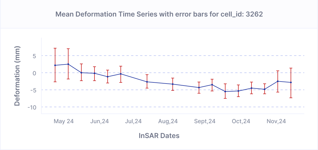
KorrAI addressed these challenges through the Open Ground Motion Service (OGMS) platform, which utilizes Interferometric Synthetic Aperture Radar (InSAR) technology.
The platform leverages data from European Space Agency’s (ESA) Sentinel-1 and RADARSAT Constellation Mission (RCM) measure millimeter-scale ground motion across large geographic regions.
At the core of this approach is UrbanSAR, KorrAI’s proprietary technique that detects stable natural reflectors to extract precise deformation data and combines it with hazard grading, a statistical model that classifies and prioritizes surface movements based on deviation from expected behaviour.
Key features of the solution include:
- Regular Monitoring: Ground deformation assessments every 12 days.
- High Precision: Millimeter-level accuracy through GNSS-calibrated data.
- AI-Enhanced Processing: Advanced algorithms identify unstable ground zones.
- Actionable Reporting: User-friendly dashboards and alerts for infrastructure operators.


Future Outlook
Enhancements will integrate additional data from ESA’s Sentinel-1C and NASA-ISRO’s NISAR satellite. NISAR’s L-band SAR sensor will improve subsurface penetration capabilities.
Ongoing refinement in KorrAI’s AI-driven algorithms will enable deformation prediction and automation of risk assessment processes.
Impact
The system empowers stakeholders to shift from reactive to proactive risk assessment and infrastructure maintenance. The implementation of OGMS has delivered significant benefits to Canadians, helping with:
- Prevention of Infrastructure Failures: Early detection of ground instability helps prevent catastrophic damage and associated costs.
- Improved Safety: Timely alerts reduce risks to residents and workers relying on vulnerable infrastructure.
- Economic Sustainability: Reduces long-term repair costs, particularly in Indigenous and remote communities.
- Climate Adaptation: Supports regional and national strategies for adapting to permafrost degradation.
- Policy Support: Enables better-informed decisions at municipal and federal levels.
Conclusion
KorrAI’s OGMS platform demonstrates the transformative power of satellite-based monitoring in addressing climate-induced infrastructure challenges. By delivering precise, scalable, and actionable ground motion data, OGMS is redefining how governments and industries approach climate adaptation.
This project aligns with multiple UN Sustainable Development Goals, including:
- Goal 9: Industry, Innovation, and Infrastructure - Enhancing infrastructure resilience through advanced monitoring technology.
- Goal 11: Sustainable Cities and Communities - Protecting infrastructure in remote communities.
- Goal 13: Climate Action - Supporting adaptation measures against climate-induced ground deformation.
Acknowledgement
This project was supported by the Canadian Space Agency under the smartEarth initiative. The project utilized Sentinel-1 SAR data provided by the European Space Agency (ESA) and was optimized for the RADARSAT Constellation Mission (RCM) provided by the Construction Research Centre of National Research Council Canada (NRC).
Contributions from industry partners and academic institutions supported statistical modelling, AI integration, and cloud computing infrastructure.
Share this post
Written By


Rob McEwan
CPO & Co-founder
Rob leads product development at KorrAI, specializing in InSAR, remote sensing, and AI-driven geospatial analysis. With a background in geology and data science, he has worked in exploration, mining, and GIS-driven analytics. Passionate about technology and creativity, he enjoys infrared photography, music, and hands-on projects in carpentry and automation.
Written By

Team KorrAI


We send the occasional email with updates, our latest blogs, and our favorite reads on InSAR and the slow moving landscape of ground subsidence.
Subscribe To Our Newsletter
Read by top professionals at


Thank you! Your submission has been received!
Oops! Something went wrong while submitting the form.
.png)
KorrAI identifies threats to critical infrastructure from ground movement using InSAR data from satellites and on-ground sensor networks.


Copyright
.svg)
2025 KorrAI