

Table of contents
Introduction
Introduction
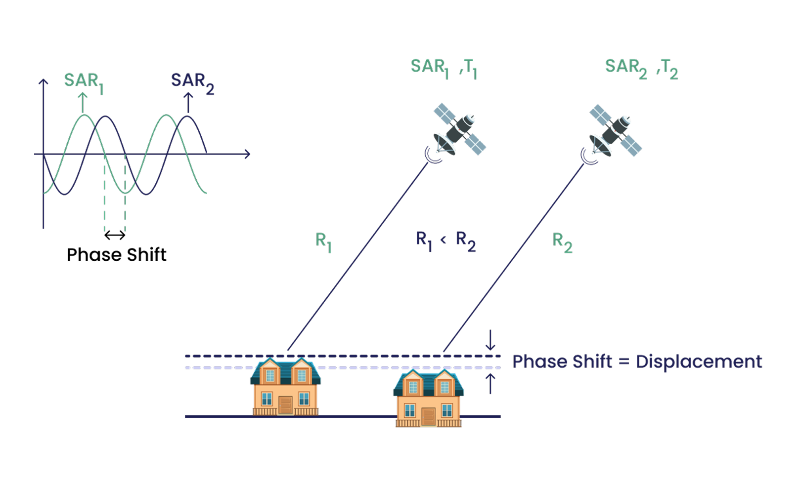
Interferometric Synthetic Aperture Radar (InSAR) is a powerful technique for monitoring ground motion at a high spatial resolution. However, raw InSAR data is often affected by noise and atmospheric disturbances. To improve accuracy, KorrAI employs a GNSS (Global Navigation Satellite System) calibration process that refines InSAR measurements by aligning them with ground-truth observations from GNSS sensors. This article details the methodology used and its advantages for geotechnical applications.
The Need for GNSS Calibration in InSAR
While InSAR is capable of detecting millimeter-scale deformations, it is subject to errors caused by atmospheric conditions, orbital inaccuracies, and signal noise. GNSS calibration helps correct these errors by providing independent, high-precision ground displacement data. This enhances the reliability of InSAR-derived displacement measurements, making them more suitable for geotechnical and structural monitoring.
KorrAI’s Calibration Methodology
KorrAI utilizes a Quasi-Persistent Scatterer (Quasi-PS) approach to calibrate InSAR data using GNSS observations. The key steps in this process include:
1. Virtual Point Creation
- A quasi-PS or virtual point is established at the precise location of each GNSS station.
- This is achieved by interpolating nearby InSAR pixels to match the GNSS location.
- The virtual point serves as a bridge between the GNSS and InSAR datasets.
%20-%20InSAR%20Calibration%20Using%20GNSS.webp)
2. Train-Test Split
- GNSS stations are divided into training (80%) and validation (20%) sets.
- Virtual points are created only for training GNSS locations, ensuring the calibration model is independently verified against unseen GNSS stations.

3. Transformation into Line-of-Sight (LOS) Data
- GNSS data provides displacement in three directions: East-West, North-South, and Vertical.
- These displacements are projected into InSAR’s LOS to enable direct comparisons.
4. Error Calculation and Correction Factor Computation
- Differences between GNSS-derived and InSAR-derived LOS displacements are calculated for each observation.
- These differences represent correction factors that are applied to the InSAR dataset.

5. Creating the Correction Surface
- A spatially interpolated correction surface is generated based on GNSS calibration data.
- This surface represents spatially varying errors in the InSAR dataset and is used to adjust InSAR measurements.

6. Applying the Calibration
- The correction surface is used to adjust the original InSAR time series at all locations.
- The result is a calibrated InSAR dataset with reduced noise and improved agreement with GNSS observations.

Advantages of KorrAI’s Approach
- Enhanced Accuracy: The correction surface significantly reduces systematic errors in InSAR data, improving measurement precision.
- Greater Reliability for Geotechnical Applications: By aligning InSAR with GNSS data, the technique provides more trustworthy insights for engineers monitoring infrastructure stability, mining operations, and landslide risks.
- Scalability: Since GNSS networks are widely distributed, this approach can be applied to large geographic areas with consistent performance.
Conclusion
KorrAI’s GNSS calibration process enhances the usability of InSAR for ground motion monitoring by refining displacement estimates with high-precision GNSS observations. This methodology ensures that InSAR data can be confidently used in geotechnical applications where accuracy is paramount. By continuously improving calibration techniques, KorrAI is paving the way for more reliable and actionable ground stability assessments.
Share this post
Written By


Ritwek Khosla
Senior Remote Sensing Scientist
Ritwek has a Bachelor of Engineering (B.E.) in Electronics and Communication Engineering. He started off in Computer Vision before discovering his passion for remote sensing and geospatial data science. Under hobbies and interests, he mentions 'all things geospatial and automation'. Talk about dedication to one's craft!
.png)
Rahul Anand
CEO & Co-Founder
Rahul is the CEO & Co-founder of KorrAI. A serial entrepreneur, he has built successful companies in consumer internet and IoT previously. Now, he has set his sights on combating ground subsidence which is expected to affect over 25% of the global population in the coming decades.
Written By

Team KorrAI


We send the occasional email with updates, our latest blogs, and our favorite reads on InSAR and the slow moving landscape of ground subsidence.
Subscribe To Our Newsletter
Read by top professionals at


Thank you! Your submission has been received!
Oops! Something went wrong while submitting the form.
.png)
KorrAI identifies threats to critical infrastructure from ground movement using InSAR data from satellites and on-ground sensor networks.


Copyright
.svg)
2025 KorrAI