

Table of contents
Introduction
This is part one of a two-part series
Mineral exploration plays a crucial role in meeting the increasing resource needs of society. As society grows, it is essential to complement mineral exploration by developing innovative and sustainable solutions to lower the impact on the environment.
Considering the influence of metal commodities on global economies, modern mineral exploration still largely relies on the geophysical and geochemical technologies developed in the 1950s. Even though much of the industry depends on conventional methods to generate targets for prospecting, companies have begun to embrace the ability of GeoAI to accelerate the interpretation workflow.
What is GeoAI?
Any data with a location component is known as geospatial data. It could be in the form of polygons representing voting districts or even pixels in a satellite image. GeoAI is an emerging scientific discipline that combines geospatial data with the tools of artificial intelligence.
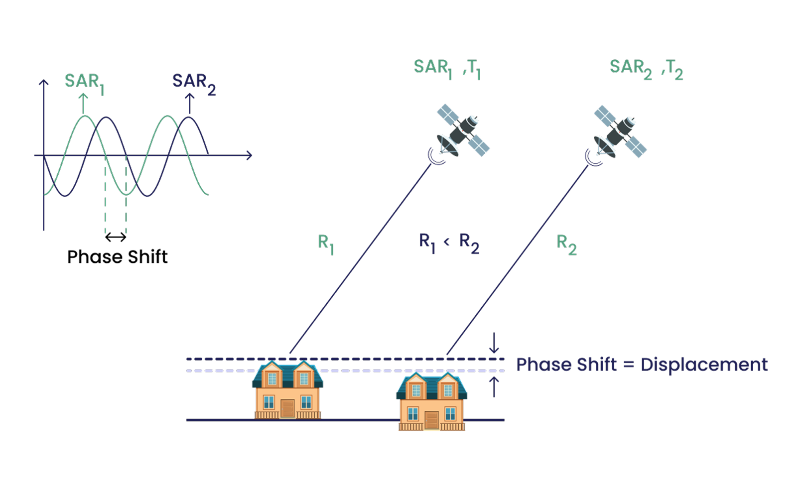
Being closer to the Earth’s surface, low earth orbit satellites take higher resolution images with increased frequency.
Much of the innovation in GeoAI has been driven by the ready availability of large-scale, high-quality data. When combined with advances in hardware and software, it is possible to derive insights and optimize systems in nearly every conceivable sector. In addition to that, the current practice of digitizing the world through geographic information systems (GIS) continues to accumulate large amounts of data, increasing the demand to efficiently organize, quantify, and analyze that data.
Integrating GeoAI with mineral exploration
Currently, the exploration industry faces a growing need to lower the high cost of exploration projects and their impact on the environment. Exploration companies now seek greater efficiency in planning efforts and higher confidence in exploration targets than the prevailing practice of relying mostly on manual methods.
Even though AI and computer vision are still far from solving all the problems of mineral exploration, the one domain that AI can assist in is the interpretation of data by utilizing iterative processes and machine learning thereby accelerating the decision-making process.
At present, geoscientists identify prospects by downloading bedrock maps and LiDAR hillshade data, digitally drawing lines and vectors to represent geological features, and overlaying them with geochemical and/or geophysical data. Using a well-trained AI, tech-savvy geoscientists can extract features in just a few seconds.
However, it is important that the AI model is trained by experts with extensive knowledge of geology and topography to provide meaningful results.
How did KorrAI get involved in this?
At KorrAI, we tried to answer a simple question — Is it possible to detect iron-stained outcrops using a computer vision model?
Using a multi-platform approach with high-resolution RGB imagery and time-series synthetic aperture radar (SAR) data, we were able to train a semantic segmentation network and generate iron alteration features across a 1000 sq. km area within 90 seconds.
Stay tuned for Part 2, where we show an end-to-end demonstration of the tools at work.
Share this post
Written By


Rob McEwan
CPO & Co-founder
Rob leads product development at KorrAI, specializing in InSAR, remote sensing, and AI-driven geospatial analysis. With a background in geology and data science, he has worked in exploration, mining, and GIS-driven analytics. Passionate about technology and creativity, he enjoys infrared photography, music, and hands-on projects in carpentry and automation.
Written By

Team KorrAI


We send the occasional email with updates, our latest blogs, and our favorite reads on InSAR and the slow moving landscape of ground subsidence.
Subscribe To Our Newsletter
Read by top professionals at


Thank you! Your submission has been received!
Oops! Something went wrong while submitting the form.
.png)
KorrAI identifies threats to critical infrastructure from ground movement using InSAR data from satellites and on-ground sensor networks.


Copyright
.svg)
2025 KorrAI